
The lex Iulia agraria, enacted by Julius Caesar in 59 BC, allowed for the distribution of public lands to the poorest citizens. Among the lands that were distributed were those of the plain at the foot of Fiesole, reclaimed and subdivided into small estates during the last decades of the first century BC. The colonisation was completed by the foundation of a new city near the Arno, which was given the name Florentia.
Dictated by the need to garrison a territory on the plain between the hills of Fiesole and the Arno, and to encourage settlement, following the completion of the land reclamation, the foundation of the Roman colony took place at an unspecified time after 59 BC, which archaeological evidence places in the early Augustan age, during the last decades of the first century BC.
The new city was established on a site that was probably already inhabited, a short distance from the Arno, and oriented in line with the cardinal points, grafting it into the regular network of drainage canals that were laid out to reclaim the surrounding countryside. The reclamation work, which overlapped with the previous Etruscan layout, arranged the territory according to a grid formed by large square areas, the centuriae, in turn subdivided into agricultural plots assigned to settlers. Separated by drains and roads and laid out parallel to the course of the Arno, and thus rotated in relation to that of the colony, the centuriae left a lasting imprint on the territory, leaving traces that are still clearly distinguishable today in the road system and in the subdivision of the Florentine plain.
The urban layout of the colony followed the classical layout of Roman foundation cities, based on an orthogonal grid of streets developed around two main axes, the cardo maximus and the decumanus maximus. Quadrilateral in shape, Florentia’s urban plan was also centred on the two major axes, which intersected perpendicularly at the centre of the city: the cardo, in a north-south direction, coincided with today’s Via Roma and Via Calimala; whereas the decumanus, in an east-west direction, is identifiable in the layout of the Via del Corso, Via degli Speziali and Via degli Strozzi. The forum – the city’s main public square – was typically placed at the intersection of the two major axes, at today’s Piazza della Repubblica. On the west side of the forum stood the Capitolium, the temple dedicated to the so-called ‘Capitoline triad’ (Jupiter, Juno and Minerva). Fairly soon, a first theatre must have been built at the south-eastern corner of the colony. The remaining part of the city was subdivided into large quadrangular blocks, separated by paved streets and occupied by the typical Roman domus, a low residential unit arranged around open inner spaces. Remains of these patrician homes have been found over time in various locations in the city centre.
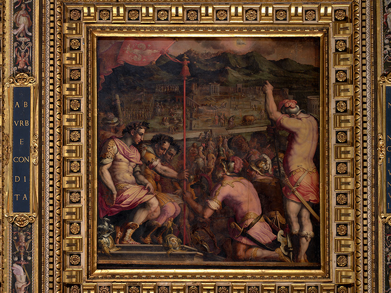
G. Vasari, G. Stradano, La fondazione di Firenze, Palazzo Vecchio, ceiling of salone dei Cinquecento
The colony was surrounded by brick walls probably shortly after its foundation, between 30 and 15 BC. Roughly rectangular in shape but perhaps with the two northern corners rounded off, to facilitate the passage of the two waterways that flanked the city, and with the southern side parallel to the course of the river, the walls were interspersed with a sequence of circular towers placed at regular intervals; the symmetry of the layout was also heightened by the presence of the four main gates, also with two towers, which were also circular.
Perhaps as early as Augustan times, an aqueduct carried water to Florentia from the Val di Marina, near Calenzano, cutting across the Florentine countryside on arches. Some of the surviving arches were still visible in the eighteenth century at the foot of the Montughi hill. The aqueduct entered the city near the northern gate and terminated near the opposite side of the walls in a large deposit known as castellum aquae, or caput aquae, which echoes in the name of today’s Via di Capaccio.
The shape of the Roman city is still clearly recognisable in the urban fabric, which in the most central part shows the imprint of the orthogonal grid of ancient streets. Even the layout of the walls has left clear signs: Via dei Cerretani on the north side, Via del Proconsolo on the east, Via Vacchereccia to the south and Via Tornabuoni to the west follow the course of the Roman defensive circle.
BIBLIOGRAPHYI
- Alle origini di Firenze. Dalla preistoria alla città romana, catalogo della mostra (Firenze, Museo Firenze Com’Era”, 25 giugno 1996-19 gennaio 1997), Firenze, Polistampa, 1996.
- Atlante archeologico di Firenze. Indagine storico-archeologica dalla preistoria all’alto medioevo, a cura di M. Pagni, Firenze, Polistampa, 2010.
- E. Scampoli, Firenze, archeologia di una città (secoli I a.C. – XIII d.C.), Firenze, Firenze University Press, 2010.
- Archeologia invisibile a Firenze. Storia degli scavi e delle scoperte tra San Lorenzo, Santa Maria Novella e Fortezza da Basso, a cura di M. Salvini e S. Faralli, Firenze, Edizioni dell’Assemblea, 2020.